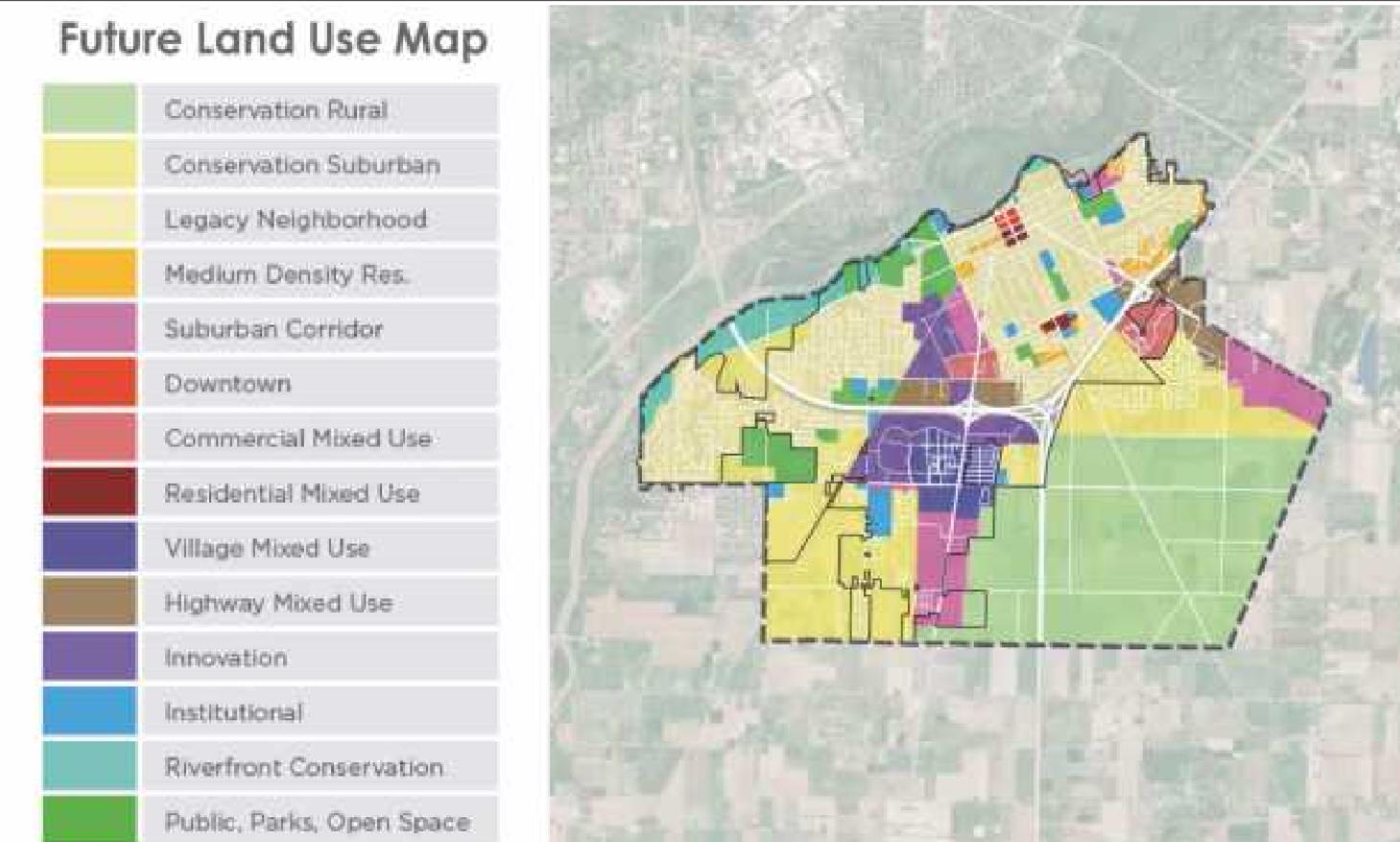
The land use map is a blueprint for how and where the city should grow. “It guides and informs future development applications and re-zonings, gives direction for how and where to make future capital improvements, sets expectations for the private sector, identifies areas for economic investments and incentives. “It is not zoning but informs future zoning changes,” Mr. Domini said.
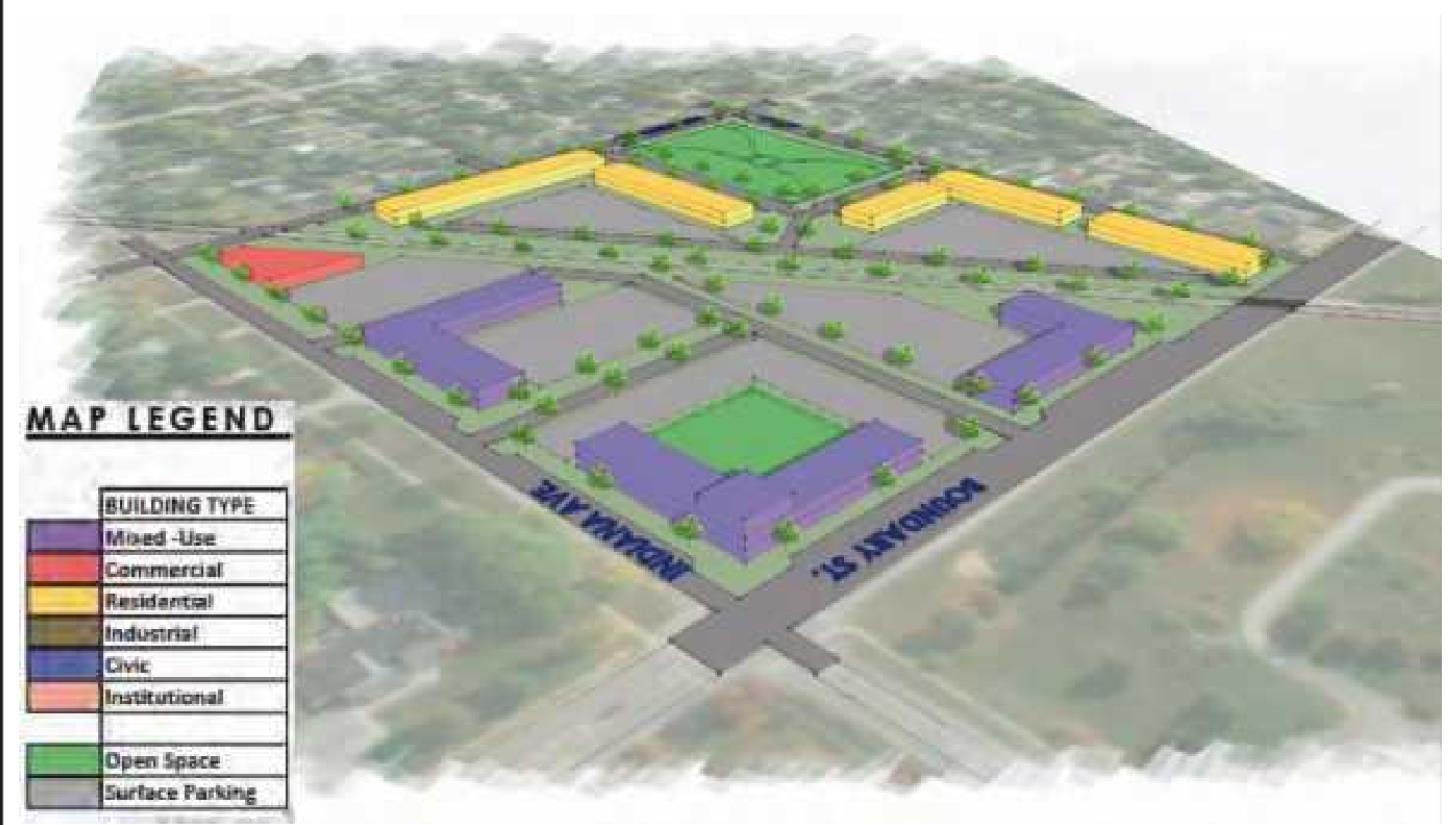
Boundary Crossing–Boundary Street and Indiana Avenue.
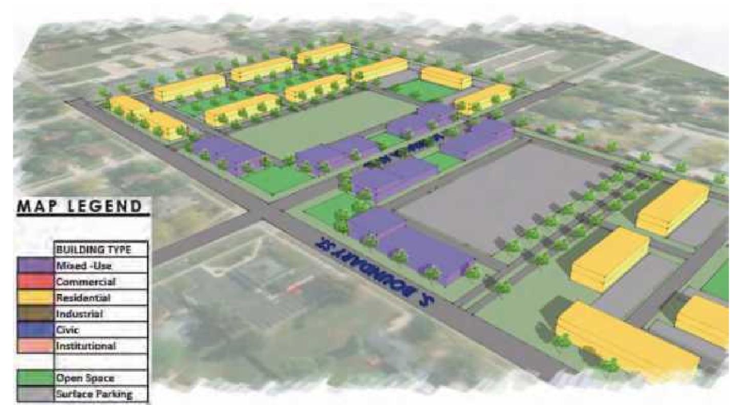
South Boundary–Country Charm Shopping Center area.
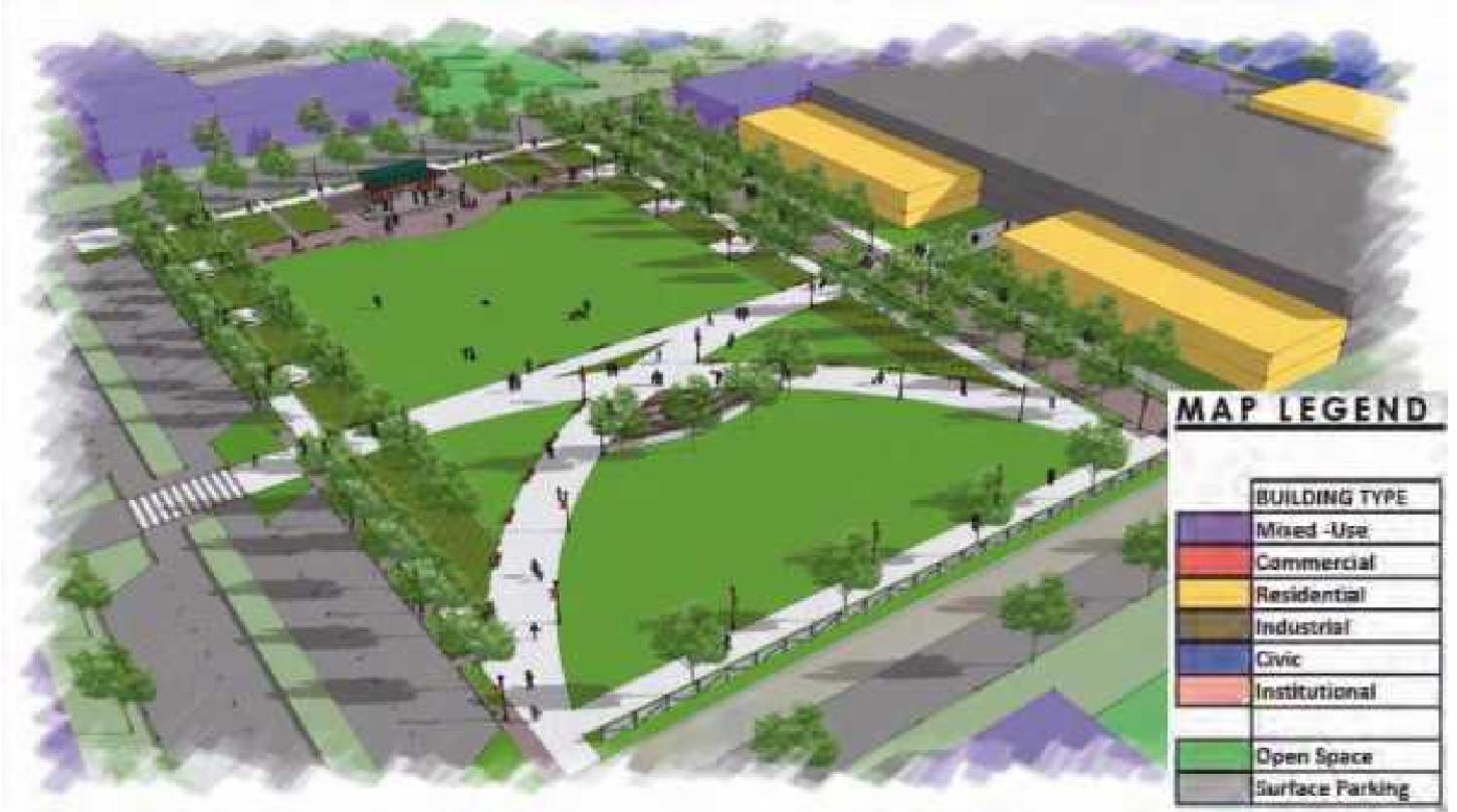
South Downtown–south of the railroad tracks, near the library and Commodore Building.
During a virtual open house April 8, Perrysburg residents learned of possible scenarios for future development.
Aaron Domini, a principal with OHM Advisors who grew up in Perrysburg, gave the presentation. OHM is an architecture and engineering firm and the primary consultant on the project.
Also providing information were representatives from Edge, a landscape architecture ...
Premium Content is available to subscribers only. Please login here to access content or go here to purchase a subscription.